HydroBall®
Mapping the inaccessible
is now possible
A small autonomous bathymetric buoy dedicated to mapping non-traditional areas such as rivers and ultra-coastal zones.
An autonomous bathymetric data acquisition solution
The HydroBall® buoy is an autonomous bathymetric data acquisition solution that is particularly efficient in non-traditional environments including rivers, canyons, reservoirs, ultra-coastal zones, and remote locations.
In 2008, at the request of Hydro-Québec, CIDCO led a technology study and wrote a summary (CIDCO, 2008) on the available solutions to support bathymetric data acquisition in turbulent waters. Essentially, the study revealed that there were no entirely satisfactory solutions currently available on the market. Zones that were difficult to navigate, either due to strong currents or very shallow depths, or zones that posed safety concerns for humans remained inaccessible and, therefore, uncharted.
In response to the study, in 2010, CIDCO began the development of the fist HydroBall® bathymetric buoy prototype. The objective was to allow surveyors and hydrographers reach and map unknown areas.
The technology has not stopped evolving since then and has been successfully deployed in a variety of projects (see examples of different applications).
Product Specifications
HydroBall® specifications
Application: measuring water depth
The HydroBall® buoy measures 15 ¾” in diameter, weighs under 28 Lb, and has an autonomy of over 24 hours.
The HydroBall® integrates three main components: a GNSS L1/L2 receiver, a miniature inertial motion sensor, and a single beam echosounder.
The GNSS L1/L2 receiver measures the buoy’s position (latitude, longitude, and ellipsoidal height). The miniature inertial sensor measures the buoy’s attitude (roll, pitch, and heading). The echosounder measures the depth under the buoy. The output of all three components are fed into a mini-controller unit inside the buoy that allows up to ten soundings per second to be referenced to the seabed. By moving the buoy over the zone to be mapped, sufficient data can be collected and modelled to accurately depict the bathymetry of the zone.
Feuille de spécification (.pdf - 243ko)
The inherent quality of the onboard sensors combined with the robustness of their physical mounting inside the buoy (known offsets) and time-synchronisation software allow the buoy’s hydrographic data to meet the highest quality data as described by the IHO’s (International Hydrographic Organisation) S-44 standards.
The HydroBall® buoy differentiates itself from other alternatives primary by:
- A compact and extremely robust design that allows deployment in high-risk zones which remain inaccessible to competing systems. For example, the buoy can be released in a river’s high current zone, towed by a helicopter or other platform of opportunity, or even mounted to an amphibious vehicle.
- An seamless software intelligence for the georeferencing, filtering, and quality analysis of the soundings collected. This approach where the parameters are constant and the processes are automated guarantee bathymetric data collection to the highest IHO standards during a deployment where the buoy operates autonomously or with a non-expert operator.
Compatible with HydroMagic,HYPACK and Caris
 |
 |
Examples
Survey monitoring with HydroMagic
SBP processing workflow
HydroBall® GNSS specifications
Applications: measuring water depth, determining chart datum, measuring wave height
Main specifications:
- Dimension: 40cm diameter
- Autonomy: 24 hours to 30 days (with external battery packs)
- Weight in air: 13kg to 85kg (with external battery packs)
- Deployment mode: autonomous
HydroBall® Calibration specifications
Applications: hydrographic surveying system calibration
Applications
River Surveys
The HydroBall® buoy was initially designed to collect bathymetric data in rivers. The buoy can be deployed autonomously for drifting freely down river, or supervised through a Bluetooth connection.
Examples
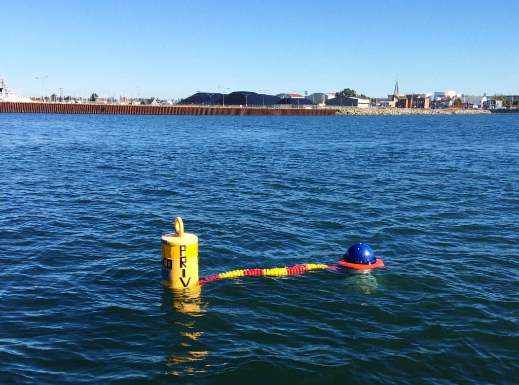
Autonomous, free-drifting deployment
“Clothesline” deployment
Helicopter-tethered deployment
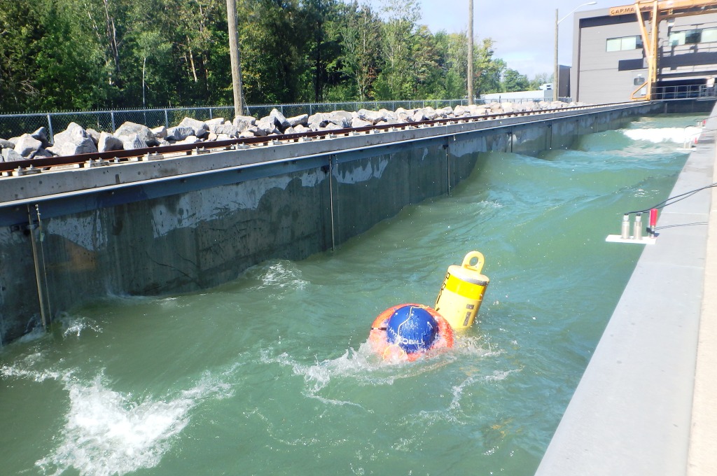
Surveying in confined areas
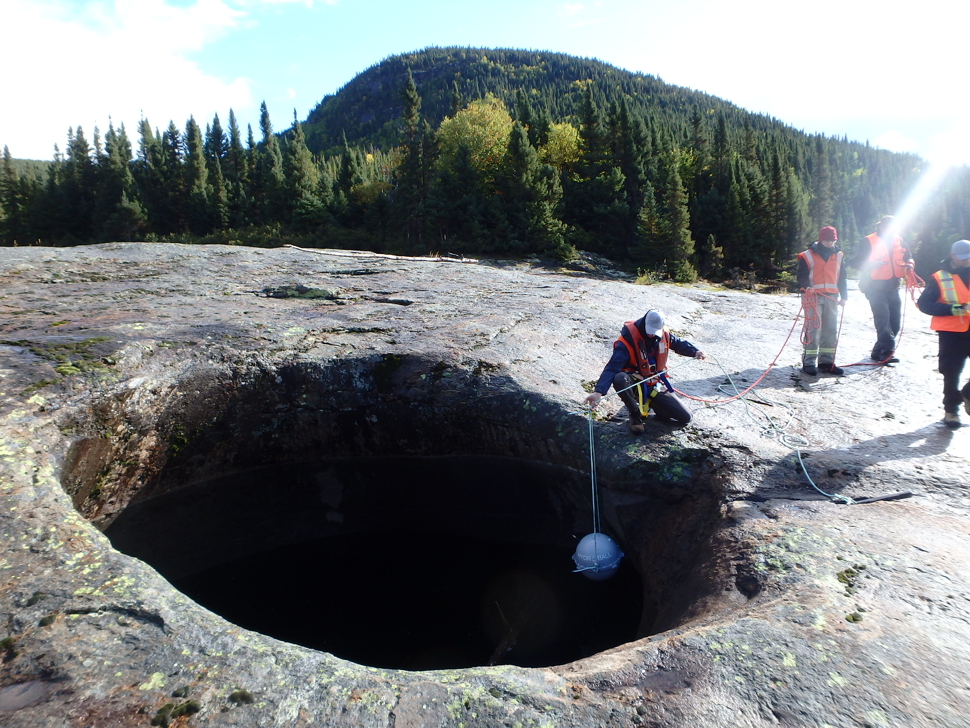
The HydroBall® buoy can be deployed in canyons, pools, and reservoirs.
Example
Pool deployment
Surveying ultra-coastal zones
The HydroBall® buoy can be mounted to amphibious vehicles or towed behind light platforms to conduct hydrographic surveys in ultra-coastal zones (<2m of depth).
Example
Deployment using an amphibious vehicle.
Conventional hydrographic survey
The pre-validated integrated design of the buoy allows for an extremely effective alternative to the classic pole-mount for traditional hydrographic surveys. The operator no longer needs to 1) install the sensors on the platform, 2) power the sensors and data acquisition computer, 3) configure the sensors and measure the offsets between the different components. This saves considerable time and greatly reduces the risk for human errors.
How to obtain a HydroBall® buoy
The HydroBall® buoy is distributed by the compagny M2Ocean Solutions Inc. For all inquiries on how to obtain a HydroBall® buoy, you can contact M2Ocean Solutions Inc. by email at kevin.wilson@m2ocean.com or by phone at +1.506.449.3109.