Equipement
CIDCO has a fleet of equipment that enables it to successfully carry out its applied research activities in hydrography.
Marine vehicles and specialized devices:
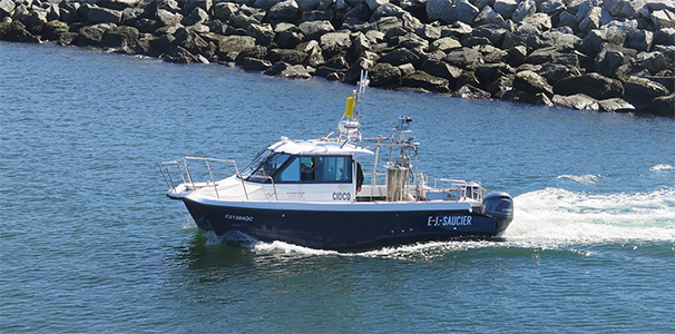
- Hydrographic vessel F.-J. Saucier
-
A highly maneuverable hydrographic vessel built for the challenging marine environment of the St. Lawrence Estuary, optimized for hydrographic and mapping missions at sea.
More information on the F.-J. Saucier
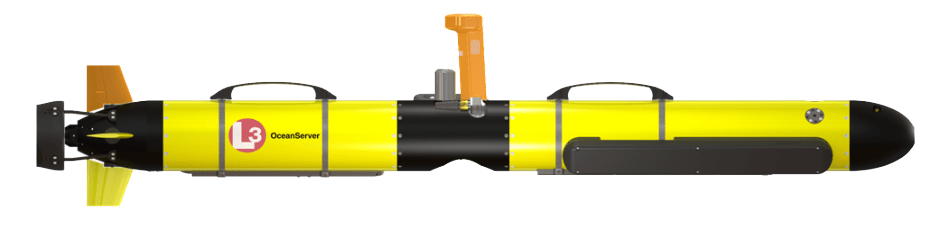
- IVER3-580 (AUV)
-
This Autonomous Underwater Vehicle (AUV) is fitted with a dual-frequency 600/1200 kHz sidescan sonar and a 2.35-megapixel camera with strobe, delivering high-resolution imagery of the seabed in challenging low-visibility environments.
More information on the IVER3
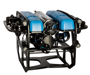
- BlueROV2 (ROV)
-
A versatile and robust Remotely Operated Vehicle (ROV), the BlueROV2 combines six powerful thrusters with an HD camera and adjustable lighting for precise underwater exploration down to 300 meters. Its live video transmission via tether makes it a reliable platform for scientific research, inspection, and exploration missions.
More information on the BlueROV2
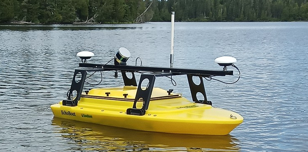
- HYDROMAP (USV)
-
Developed by CIDCO, the HYDROMAP is an advanced Unmanned Surface Vehicle (USV) based on the EchoBoat-160™ platform. Integrating a high-resolution multibeam sonar, a 3D LiDAR, and an inertial navigation system, it enables precise mapping above and below the waterline, making it an ideal tool for detailed port infrastructure inspections and coastal surveying.
More information on the HYDROMAP
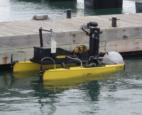
- Catarob-ATS Subsea (USV)
-
The Catarob-ATS is a lightweight, modular Unmanned Surface Vehicle (USV) designed for shallow-water hydrographic surveys. Versatile and easy to deploy, it supports multiple payloads as the Pico MB-120 multibeam echosounder, delivering reliable performance with with stable operations and semi-automatic navigation.
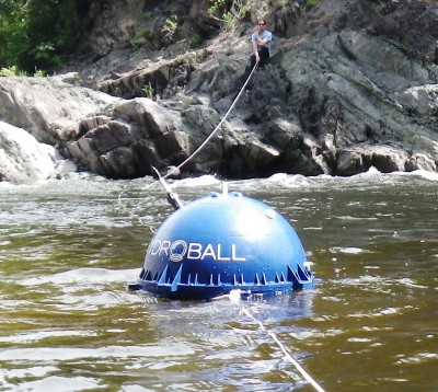
- HydroBall®
-
The HydroBall® is a compact autonomous bathymetric buoy developed by CIDCO, specifically designed for mapping non-traditional environments such as rivers and ultra-coastal zones. Equipped with three core sensors — an L1/L2 GNSS receiver, a mini inertial navigation unit, and a single-beam echosounder — it delivers precise and detailed depth measurements. Rugged, lightweight, and easy to deploy, the HydroBall® offers a reliable solution for extending hydrographic coverage into challenging areas. The HydroBall® is commercialized through our partner M2Ocean.
More information on the HydroBall®
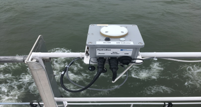
- HydroBlock®
-
The HydroBlock® is a compact autonomous bathymetric unit developed by CIDCO, designed to be easily mounted on a boat. It automates the processing and enables real-time distribution of bathymetric data collected by the vessel’s single-beam echosounder. Simple to use, it brings automation and efficiency to hydrographic operations in support of crowdsourced bathymetry (CSB). The HydroBlock® is commercialized through our partner M2Ocean.
More information on the HydroBlock®
Sonar Systems:
- KONGSBERG EM2040P (MBES)
-
Designed for high-precision hydrographic surveys in shallow waters, the Kongsberg EM2040P multibeam echosounder offers up to 170° swath coverage and outstanding resolution thanks to its wide frequency range (200, 300, 400, 600, or 700 kHz), dual-frequency mode, and advanced motion stabilization capabilities, all in a compact and portable form factor. It delivers bathymetry (depth), backscatter imagery, and water column measurements down to 250 m.
Kongsberg EM2040 MBES Technical Datasheet
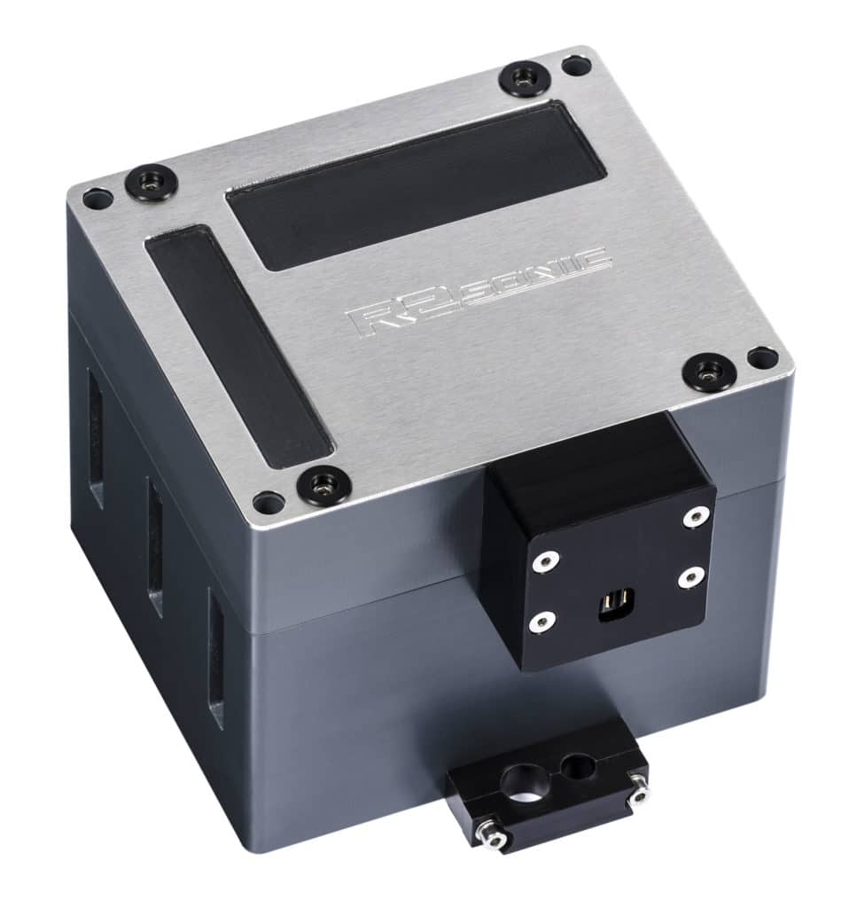
- R2SONIC Sonic 2020 (MBES)
-
Ultra-compact and easy to integrate on any type of platform, the R2Sonic Sonic 2020 multibeam echosounder provides up to 160° swath coverage, user-selectable frequencies from 200 to 450 kHz (with optional 700 kHz), and up to 1024 soundings per ping for ultra-high resolution shallow-water surveys. It is an integral component of bathymetric systems deployed on surface vessels, USVs, or ROVs to measure and map the seafloor across a wide range of applications.
Sonic Series Technical Datasheet
- RESON SeaBat 7125 (MBES)
-
The SeaBat 7125 is a dual-frequency (200/400 kHz) multibeam echosounder designed for high-precision hydrographic surveys from 0.5 to 500 meters depth. With 512 beams, up to 165° swath coverage, and advanced functionalities such as stabilization, FlexMode, and Dual Head configuration, it delivers exceptional quality bathymetric and seafloor imagery data, even at high survey speeds.
SeaBat 7125 Technical Datasheet
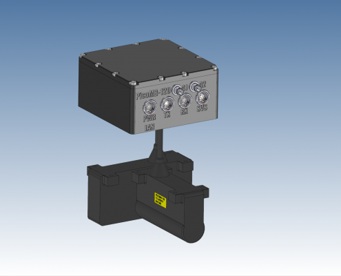
- PICO MB-120 (MBES)
-
The PicoMB-120 is a lightweight and cost-effective multibeam echosounder designed for shallow to medium-depth hydrographic surveys. Offering a 120° swath with 256 acoustic beams, it operates in the 300–400 kHz frequency band and delivers precise measurements down to 240 m. Compact, energy-efficient, and easy to integrate on small vessels or autonomous platforms, it is particularly well suited for installation on Unmanned Surface Vehicles (USVs).
PicoMB-120 Technical Datasheet
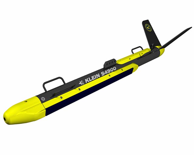
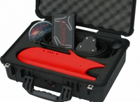
- SSS : KLEIN S4900
-
The Klein S4900 is a portable, high-resolution side scan sonar designed for search, recovery, and hydrographic survey operations in coastal waters. Featuring dual-frequency CHIRP technology (455/900 kHz), it delivers exceptionally clear underwater imagery at ranges of up to 200 m per side and depths down to 300 m, even at long distances.
Klein S4900 Technical Datasheet
- STARFISH 990F (SSS)
-
Compact, lightweight, and USB-powered, the StarFish 990F is a high-frequency (1 MHz) side scan sonar designed for shallow-water surveys, search, and rescue operations. Easy to transport and deploy, it delivers exceptionally clear seabed imagery at ranges of up to 35 m per side, all in a portable format that fits into a backpack.
StarFish 990F Technical Datasheet
- KNUDSEN Chirp 3212 (SBES)
-
The Knudsen Chirp 3212 is a dual-channel CHIRP single-beam echosounder designed for high-resolution sub-bottom profiling. Operating across a wide range of user-selectable frequencies from 3.5 to 210 kHz, it achieves seabed penetration of up to 7000 meters depending on the transducer used. Widely employed in geophysics, marine archaeology, and sediment layer reconnaissance, the 3212 offers maximum flexibility with real-time CHIRP signal processing, a rugged portable waterproof design, and full compatibility with industry-standard software such as Hypack, QINSy, and SonarWiz.
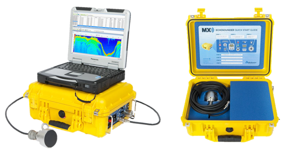
- BioSonics MX
-
The BioSonics MX is a portable single-beam echosounder designed for aquatic habitat characterization, including mapping submerged vegetation, classifying substrates, and producing high-precision bathymetric data in shallow waters. Operating at 204.8 kHz with an 8.5° conical beam, it features an integrated DGPS and comes with a comprehensive software suite for data acquisition, analysis, and visualization.
BioSonics MX Technical Datasheet
LiDAR Systems:
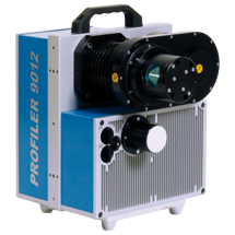
- LiDAR Z+F 9012A
-
The Z+F PROFILER® 9012 is a high-speed phase-based laser scanner offering a 360° field of view, a range of 119 m, and an acquisition rate of over one million points per second. Compact, precise (0.1 mm resolution), and robust (IP54), it is ideal for mobile 3D mapping and high-density profiling applications, even at high travel speeds.
Z+F PROFILER® 9012 Technical Datasheet
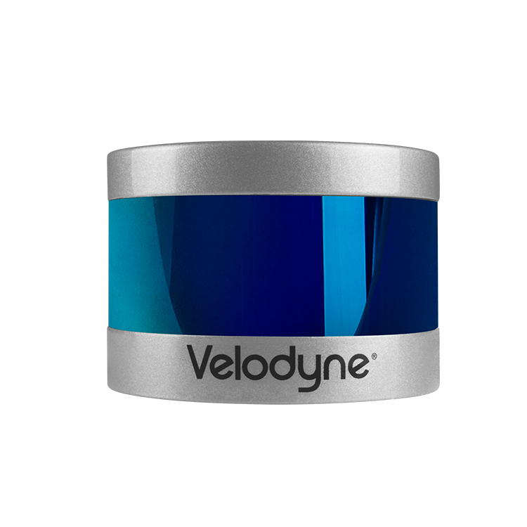
- LIDAR VELODYNE PUCK (VLP-16)
-
The VLP-16 Puck is a lightweight, compact 16-channel LiDAR sensor offering 360° horizontal coverage, a 30° vertical field of view, and a range of up to 100 meters. With a data rate of up to 600,000 points per second, it delivers accurate real-time 3D data for applications such as mapping, robotics, UAVs, autonomous vehicles, and environmental studies.
Velodyne Puck VLP-16 Technical Datasheet
Cameras:
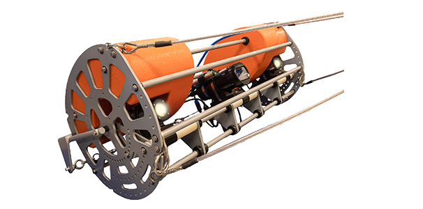
- SubC Tow Camera System
-
The SubC Tow Camera System is a robust and comprehensive solution for benthic observations, seabed mapping, and oceanographic research. Equipped with a Rayfin Coastal 4K/HD camera and an integrated video recorder, it enables simultaneous capture of live video up to 4K and high-resolution still images (12.3 MP). With a rugged marine frame, built-in sensors (depth, altitude, tilt, NMEA), and deployment capability down to 380 m, it is an ideal tool for fisheries research, marine archaeology, conservation, and search and rescue operations.
SubC Tow Camera System Technical Datasheet
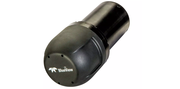
- TELEDYNE BlueView P900-130 2D
-
The P900-130 is a compact 2D acoustic camera capable of delivering up to 15 images per second with a 130° horizontal and 20° vertical field of view. Operating at 900 kHz with 768 beams, it provides precise, real-time detection for navigation, object identification, obstacle avoidance, underwater inspections, and search and rescue operations.
BlueView P900-130 Technical Datasheet
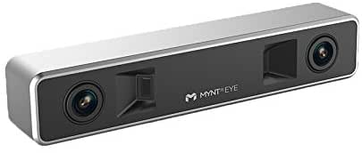
- MYNT Eye 3D Stereo Camera
-
The MYNT Eye is a compact 3D stereo camera featuring a detection range of 0.5 to 18 m, a 146° field of view, and a frame rate of 60 fps, ideal for drone navigation, logistics, obstacle avoidance, and visual recognition. It integrates dual IR projectors, a 6-axis IMU, and a USB 3.0 interface, enabling fast and reliable integration in complex environments.
MYNT Eye 3D Stereo Camera Technical Datasheet
GNSS Systems:
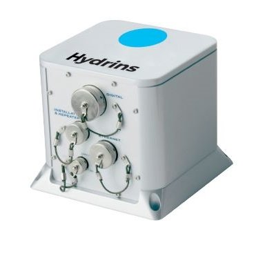
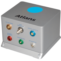
- IxBlue (Exail) HYDRINS and ATLANS-C
-
The HYDRINS is a high-performance Inertial Navigation System (INS) optimized for hydrographic surveys with multibeam echosounders. Based on FOG (Fiber Optic Gyroscope) technology, it provides highly accurate position, attitude, and heading data even during GNSS outages, with integrated Smart Heave™ correction and advanced post-processing capabilities through the Delph INS software.
The ATLANS-C is a compact and lightweight all-in-one solution combining a FOG INS with an RTK GNSS receiver. Designed for mobile mapping applications on land and in the air, it delivers robust real-time positioning and centimeter-level accuracy in post-processing, even in GNSS-challenged environments. With its small footprint, low power consumption, and absence of moving parts, it integrates seamlessly into any type of mobile platform.
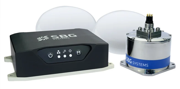
- Navsight Marine – Ekinox (SBG Systems)
-
The Navsight Marine – Ekinox (SBG Systems) is a high-precision inertial navigation and GNSS solution designed for hydrographic and marine applications. Equipped with a powerful IMU and an integrated GNSS receiver, it delivers real-time position, orientation, and velocity with centimeter-level accuracy. Compact, robust, and optimized for multibeam survey operations, it ensures maximum reliability even in challenging marine environments.
Navsight Marine – Ekinox (SBG Systems) Technical Datasheet
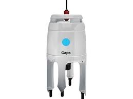
- iXblue (Exail) GAPS
-
The GAPS (iXblue, now Exail) is an integrated USBL acoustic positioning and inertial navigation (INS) system designed to locate and communicate with subsea assets. Combining a 3D acoustic antenna and a fiber-optic gyroscope INS in a compact, pre-calibrated, and easy-to-deploy unit, it delivers outstanding accuracy and ease of use. Offering 200° coverage, centimeter-level positioning accuracy (depending on acoustic conditions), and ranges exceeding 4000 m, GAPS is ideally suited for tracking ROVs, AUVs, towed vehicles, divers, and complex offshore operations.
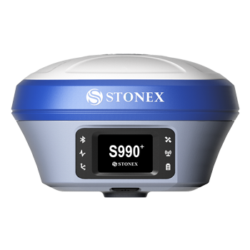
- STONEX S990+
-
The Stonex S990+ is a high-precision GNSS receiver supporting multi-constellation and multi-frequency tracking (1,408 channels), enhanced with IMU technology for tilt compensation up to 60°. Compact and robust, it captures all GNSS signals (GPS, GLONASS, BeiDou, Galileo, QZSS, IRNSS) and delivers centimeter-level accuracy even in challenging environments. With full connectivity (Bluetooth, Wi-Fi, UHF radio, 4G modem) and a long-lasting rechargeable USB-C battery, it is the ideal solution for demanding surveying and geodetic applications.
Stonex S990+ Technical Datasheet
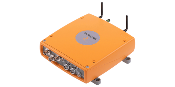
- Septentrio AsteRx-U
-
The Septentrio AsteRx-U is a multi-constellation, multi-frequency GNSS receiver equipped with dual antennas to provide both position and orientation with centimeter-level accuracy. Compact and robust (IP67), it integrates advanced interference and multipath mitigation technologies, along with full connectivity options (Ethernet, USB, Bluetooth, Wi-Fi, and cellular modem). Ideal for terrestrial and marine applications requiring reliable real-time positioning, it ensures stable tracking even in complex environments.
Septentrio AsteRx-U Technical Datasheet
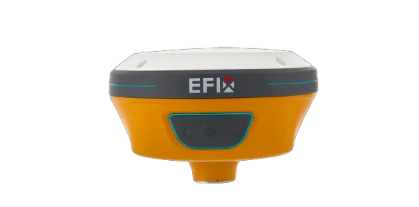
- Efix C5
-
The Efix C5 is a multi-frequency GNSS receiver with 1,008 channels, fully compatible with all constellations (GPS, GLONASS, Galileo, BeiDou, QZSS). Equipped with a 4D IMU, it ensures precise RTK positioning even during temporary signal interruptions. Rugged and waterproof (IP67) with up to 15 hours of autonomy, it also offers full connectivity, including Bluetooth, Wi-Fi, UHF, and NFC. Ideal for surveying and staking tasks, it delivers speed, reliability, and accuracy in the field.
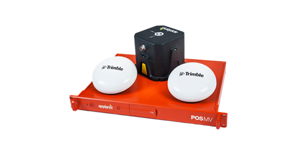
- Applanix POS MV 320
-
The Trimble Applanix POS MV 320 is an integrated positioning and orientation system designed for demanding marine applications. By combining multi-constellation GNSS, an inertial measurement unit (IMU), and GPS Azimuth Measurement Subsystem (GAMS), it delivers real-time position, attitude, heading, roll, pitch, and heave with centimeter-level accuracy through the RTK option. Compact, rugged, and available in a submersible IP68 version, it ensures reliable georeferencing and motion compensation even in challenging navigation conditions.
POS MV 320 Technical Datasheet
Other Equipement:
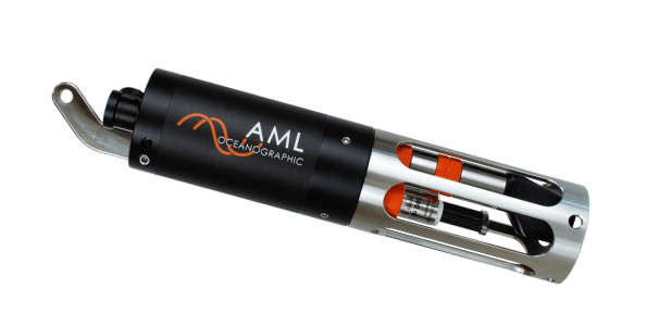
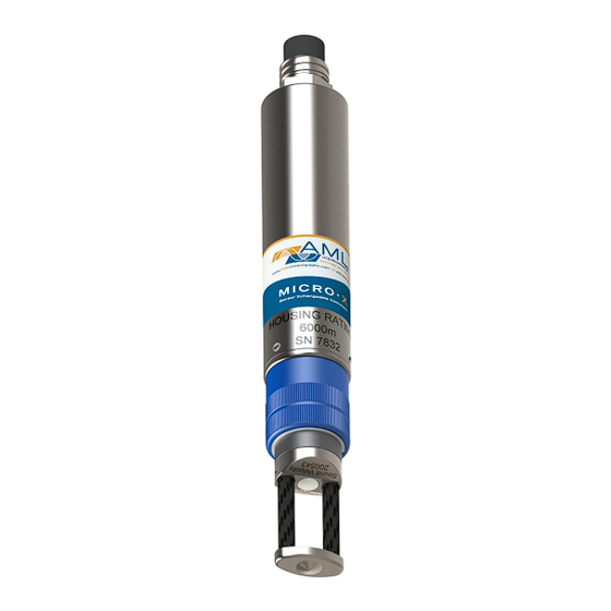
- AML 3 and Micro X
-
The AML-3 and Micro X are two high-precision modular oceanographic probes designed to measure sound velocity, conductivity, temperature, and other key parameters in marine environments. Featuring Xchange™ technology, their sensors can be swapped quickly in the field without tools while preserving calibration. The AML-3 provides robustness and versatility tailored to hydrographic surveys and demanding conditions, while the smaller Micro X is ideal for spot measurements or use in confined spaces. Together, they offer a flexible and reliable solution for scientific research, hydrography, and industrial marine applications. Both are ideally suited for deployment on instrumented buoys, ROVs, or any type of oceanographic monitoring system.
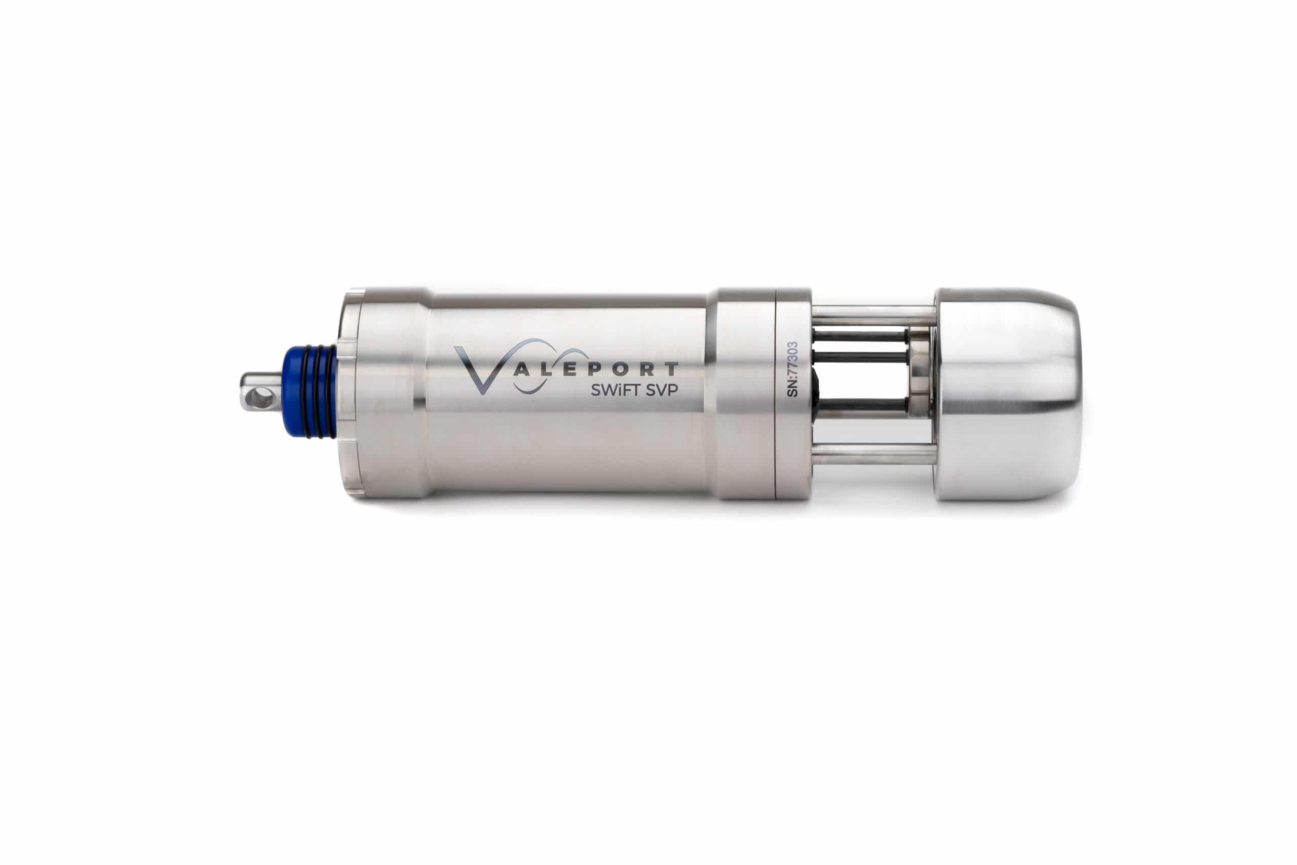
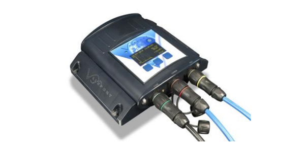
- Valeport SWiFT SVP
-
The Valeport SWiFT SVP is a compact and robust sound velocity profiler designed to quickly deliver accurate sound speed profiles as a function of depth. With its intuitive interface and Bluetooth connectivity, it ensures efficient deployment and recovery, along with immediate data transfer in the field. Ideal for multibeam survey corrections and demanding hydrographic applications, it provides high reliability even in complex marine environments.
Valeport SWiFT SVP Technical Datasheet
- Marine Magnetics SeaSPY2
-
The Marine Magnetics SeaSPY2 is a marine Overhauser magnetometer with an omnidirectional sensor, offering ultra-high sensitivity (0.01 nT) and outstanding absolute accuracy of 0.1 nT. Designed to operate with no dead zones or heading error, it delivers reliable survey data in all orientations and conditions, from –40 °C to +60 °C. Compact (12 kg) and hydrodynamic, it is ideal for towed configurations, integration with AUVs, or use alongside side scan sonars. Rugged and maintenance-free, it features a leak detector, rapid diagnostic system, and low power consumption (3 W), ensuring extended missions on a single battery. Perfect for geophysical and oceanographic applications requiring precise and repeatable magnetic measurements.
- RBRvirtuoso3 D logger
-
The RBRvirtuoso³ D is a high-precision single-channel data logger capable of integrating almost any RBR sensor, including those for temperature, pressure, dissolved oxygen, turbidity, fluorescence, pH, and photosynthetically active radiation. Designed for long-term deployments, it offers a large storage capacity (up to 240 million measurements), optimized battery autonomy, and comprehensive connectivity (USB-C, Wi-Fi, RS-232/485). Available in plastic or titanium housings (rated up to 10,000 m), it is suitable for moored, towed, or profiling configurations, with sampling rates of up to 32 Hz. With real-time communication capabilities and a rugged design, it is the ideal solution for demanding oceanographic measurements, even in extreme conditions.
RBRvirtuoso³ D Technical Datasheet

- Valeport TideMaster
-
The Valeport TideMaster is a versatile and precise tide gauge. This compact water level recorder, suitable for both fresh and saltwater, is designed for short- or long-term tide and water level measurements using either a pressure sensor or radar sensor. Compact, rugged (IP67), and energy-efficient, it can operate autonomously for up to one year on tool-free replaceable batteries. It features an integrated display panel, Bluetooth communication, SD card data logging, and interfaces for meteorological sensors, while maintaining compatibility with a wide range of hydrographic software. Ideal for coastal and port deployments, it can be complemented with telemetry modules for real-time monitoring.
Valeport TideMaster Technical Datasheet
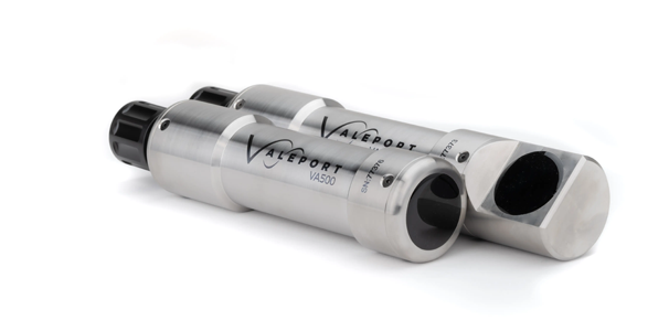
- Valeport VA500
-
The Valeport VA500 is a high-precision acoustic altimeter capable of measuring the distance between the sensor and the seabed or a structure with millimetric resolution using its 500 kHz transducer. Compact and rugged (IP68), it can optionally integrate a pressure sensor to provide reliable, real-time depth data. Thanks to its versatility, it is well suited for applications on ROVs, AUVs, towed systems, or as part of oceanographic instrumentation.
Valeport VA500 Technical Datasheet
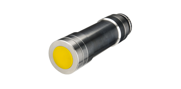
- Tritech PA200/PA500 MKI
-
The Tritech PA200/PA500 MKII is a digital precision altimeter designed for demanding underwater environments. Delivering millimetric accuracy and reliable performance through Tritech’s proprietary signal processing engine, it is available in 200 kHz and 500 kHz versions to cover a wide measurement range (from a few centimeters up to 100 m). Compact and lightweight, it integrates an inclinometer for real-time pitch and roll correction and offers configurable digital and analog outputs. With housing options rated to depths of up to 6800 m and full compatibility with Tritech systems as well as other industrial interfaces, it is ideal for ROVs, AUVs, under-ice operations, oceanographic integration, or subsea structure monitoring.
Tritech PA200/PA500 MKII Technical Datasheet
- And much more...
Feel free to contact us for any requests or specific needs regarding specialized equipment.