Program
To provide students with the theoretical and practical basics
This course aims to provide the theoretical foundations and practical field experience in order to enable hydrographic surveyors to execute hydrographic surveys, to monitor and evaluate survey data quality. The job profiles of graduated students are targeted on :
- Watch leaders positions on a large survey operation (nautical charting surveys, off-shore surveys)
- Hydrographic surveyors on survey units deployed for localized survey operations (ports, coastal engineering surveys, inland waters, survey launch in support of a large scale survey operation).
The learning outcomes of this course are :
-
Knowledge of the marine environment in the context of a hydrographic survey;
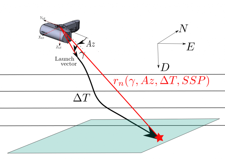
- Knowledge of operation principles of hydrographic system components (Single Beam and Multi Beam Echo Sounders, Positioning systems, Inertial Navigation Systems, Tide measurement sensors and systems, Undersea systems (positioning systems, autonomous underwater vehicles, remote surveys systems, acoustic imagery systems) and data quality assessment;
- Ability to set-up a hydrographic system in a survey vessel, awareness of data quality required by hydrographic instructions;
- Execution of a hydrographic survey within a specified level of data quality and in compliance with safety rules;
- Execution of data processing tasks using dedicated software for the production of hydrographic products (geo-referenced digital sea-floor models, acoustic imagery).
Sequence of the training course
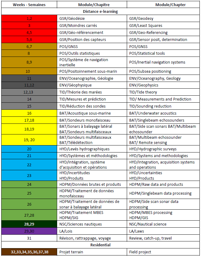
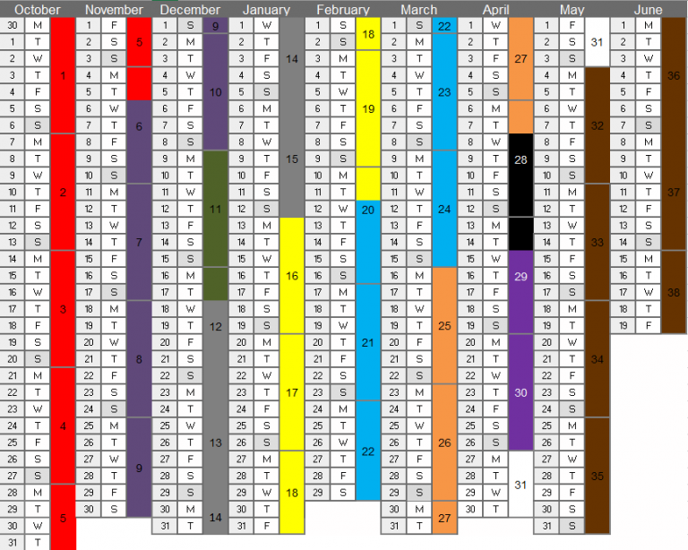
1- E-learning course modules (9 months)
This mode of delivery includes:
- Unlimited access to the CIDCO e-learning platform, which includes videos, electronic lessons and self assessment quizzes, an impressive number of data sets to illustrate the major concepts of each modules;
- Simulation programs written in SCILAB;
- GNSS datasets handleable in RTKLIB;
- Data layers handleable in QGIS;
- Access to CIDCO server to run professional software for bathymetric data processing (Caris HIPS&SIPS);
- Web-conferences;
- Tutoring by CIDCO experts.
- Geodesy and spatial referencing (GSR)
-
Content outline:
The part devoted to geodesy (geometrical, physical, map projections) is, in view of the entry requirements, a refreshing module. The Least square theory, with example of usage in hydrography is detailed in the second part. A refreshing module on land surveying with focus to hydrographic measurements is done in the third part.The main learning outcomes of GSR are:
Describe geodetic reference systems in use and achieve transformations between geodetic systems; Perform geodetic line computation and map projections. Measure and adjust survey control data from angle and distance measurement devices. Understand mobile mapping concepts and associated frames, perform data spatial referencing from hybrid measurements of position, orientation and ranging.- It is followed by a comprehensive study of spatial referencing of mobile survey systems hybrid measurements (Positioning, Plateform attitudes, range measurement by single and multibeam echo sounders and LiDAR). This part includes a description of the different frames (local geodetic, survey plateform body frame, sensor frames) and associated transformation between these frames.
- Positioning – POS
-
Content outline:
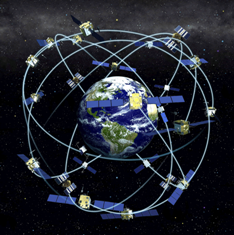
Global Navigation Satellite Systems (GNSS). This part presents the fundamentals of GNSS and describes the GPS, GLONASS, GALILE and BEIDOU system. The module introduce the use of RTKLIB, a free software for GNSS post-processing. Statistical tools details the statistical analysis of least square solution, with application to hydrographic problems. A detailed presentation of Inertial Navigation Systems (INS) comprises principles, practical alignement of INS, the problem of heave estimation, and INS/GNSS hybrid systems.The main learning outcomes of POS are:
To operate a hybrid positioning system and to perform positioning quality control. To differentiate the main GNSS modes and interpret quality factor in relation to sources of errors. To describe the principle of acoustic positioning system, to perform LBL and USBL calibration. Understand the concepts of inertial navigation systems, perform the static and dynamic alignment of an INS, describe heave measurement principle and sources of errors.- Subsea positioning presents the principle of acoustic positioning , including Short baselines, Ultra Short base lines, Long base lines.
- Environment – ENV
-
Content outline:
Physical oceanography, composition of sea water and its influence on acoustic propagation; Marine geology gives the fundamental of seabed composition, sediments and deposition, seabed sampling techniques ;The main learning outcomes of ENV are:
To understand the role of ocean physical parameters observations in support to a hydrographic survey, global/coastal ocean circulation and sediment transport principles To describe magnetic and gravity surveys To describe seismic surveys and the role of surface and acoustic positioning- Marine geophysics outline the main types and applications of seismic surveys, gravity surveys, and magnetic surveys.

- Tides and Water Levels – TID
-
Content outline:
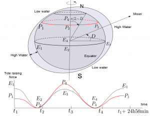
Tide theory, the origin of tide raising forces, tidal regimes. Tide measurement, different technology of tide gauges. Tide prediction. Introduction to tide modeling and usage of tide prediction tools .The main learning outcomes of TID are:
To describe the static tide theory, identify tidal regimes and harmonic constituents of a tide prediction model To use tide prediction models and to be aware of non tidal effects on water levels To deploy, calibrate and use tide poles and tide gauges To describe chart datums and separation models- Sounding reduction techniques from tide information and depth measurements.
- Bathymetry – BAT
-
Content outline:
Underwater acoustics, acoustic transducers, propagation of sound in sea water; Single beam echo sounders; Side scan sonars;The main learning outcomes of BAT are:
To set-up a bathymetric measurement system, with the knowledge of oceanographic data and seafloor composition; To interpret water column data and sounders returns of a bathymetric system from the knowledge of acoustic parameters and environmental conditions; To calibrate, apply quality control procedure of acoustic depth measurement systems. To set and optimize on-line acoustic parameters of a bathymetric system; To calibrate and set the acoustic parameters of a seafloor imaging system; interpret seafloor imaging for obstructions search; To describe several non acoustic bathymetry techniques.- Multibeam echosounders;
- Bathymetric LiDAR;
- Hydrography – HYD
-
Content outline:
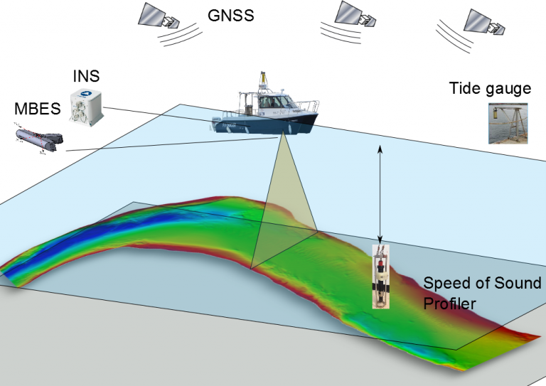
This module details the methodology of different types of surveys, review the quality standards which apply to survey data, and describes the different types of survey system and their integration to survey vessels.
Risk of grounding, different types of hydrographic surveys, introduction to depth measurements; Survey systems and survey methodologies; Data uncertainty, data quality standards ;The main learning outcomes of HYD are:
To execute a survey plan, for various types of hydrographic surveys To understand survey specifications and to check their adequacy with a survey system To install, set-up and calibrate a survey system To understand the source of errors of a survey system and to execute quality control procedure To produce survey documentation- Data acquisition system, integration of hydrographic survey systems;
- Products and reports.
- Hydrographic Data Management – HDM
-
Content outline:
Hydrographic data management comprises data processing and is presented together with professional software tools, like CARIS HIPS/SIPS. The module includes the concepts of GIS, and practicals make uses of the freeware QGIS.
Raw data and acquisition systems; Hydrographic data processing principle; Single and multibeam echosounder system data processing;The main learning outcomes of HDM are:
To process swath echo-sounder systems data from raw data to digital terrain models, in particular to be able to detect systematic errors, and apply data quality assessment methods To process SBES data, apply interpolation methods and evaluate DTM uncertainty To process (compensation, mosaics) side-scan sonar and interpret side-scan images To integrate survey data into a GIS, structure survey data, and manage metadata. Produce minutes of bathymetry- Side scan sonar imagery;
- GIS;
- Hydrographic data format, data exchange and nautical charts.
- Nautical Science -NsC
-
Content outline:
- Meteorology;
- Seamanship;
- Survey operation and safety at sea;
- Navigation;
- Communications at sea.
The main learning outcomes of NsC are:
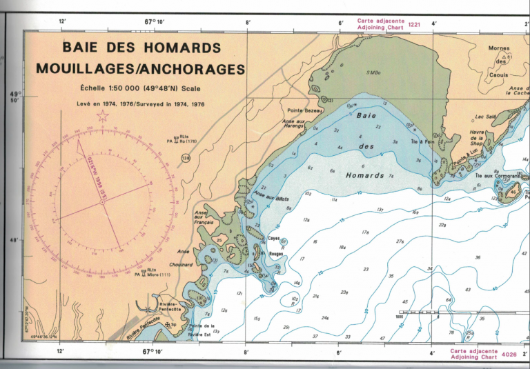
- To understand the content of a nautical chart, the impact of data quality on a chart and plot points, routes on a chart
- To get awareness of safety and emergency procedures on surveys vessels
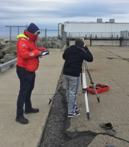
- To describe and practice instrument mooring, launching and recovery
- To describe the main meteorological elements and to produce a short term forecast based on observations
- Law of the sea – LAW
-
Content outline:
This module presents the essential of the United Nation Convention on the Law Of the Sea (UNCLOS) related to hydrographic activities. It also comprise a description of contract in the framework of hydrographic data production.
UNCLOS, delimitations; Liability of the Hydrographic SurveyorThe main learning outcomes of LAW are:
Understand the legal aspects related to the work of the hydrographic surveyor (contractual considerations and legal liability) Describe the international legal framework in which the hydrographic survey takes place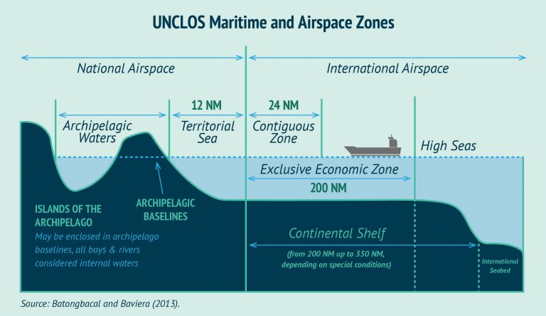
2- Hydrographic survey project (5 weeks), on the Saint-Lawrence River at Rimouski, Québec, Canada.
Foreign students: You will need a visitor visa during the period of stay in Rimouski. Please make sure you are eligible for such a visa before registering for the course. No refunds will be made in the event of your inability to obtain a visitor visa to Canada for the field training period. Also note that participation in the field project is mandatory in order to complete your degree and obtain your certificate attesting the successful completion of the Category B training program recognized by IHO.
The final field project represents the finality of the course.
The project lasts 7 weeks including one week of exams.
The work is done in class and in the field (marina of Rimouski, St. Lawrence River).
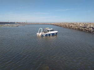
The students have at their disposal a number of hydrographic equipment, specialized software and the CIDCO hydrographic boat.
The learning outcomes of the course are:
- Plan and organize data acquisition tasks for a hydrographic survey
- Understand hydrographic instructions and detailed specifications for acquisition, processing and quality control
- Produce different types of data and perform quality analysis to meet standards
- Provide hydrographic products from acquired data
- Write reports and survey documentation
About Rimouski
Bordered on the north shore by the majestic St. Lawrence River on nearly 50 kilometers, Rimouski is characterized by the dual identity of the regional capital of Lower St. Lawrence and the Oceanography Capital of the province of Québec.