Depthstar
hydrographic data processing software
DepthStar is a hydrographic data processing software
![]()
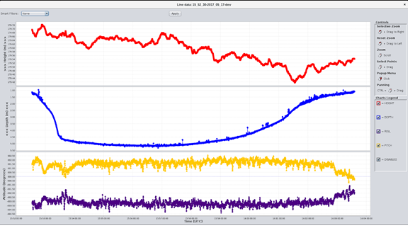
Sensor Data View and Editing
Data from every sensor is readily accessible and can be filtered manually or automatically using several filters such as moving average or GPS quality (PPK only).
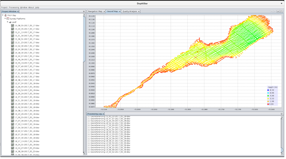
Georeferencing
Multiple sounding reduction modes are available. Depthstar can georeference each sounding with respect to the ellipsoid (ERS mode) or to the water level (WLRS mode).
Positioning methods
Depthstar supports state of the art positioning correction such as PPK (Post Processed Kinematics) and PPP (Precise Point Positioning) to improve GPS accuracy.
Advanced Raytracing
Advanced acoustic raytracing algorithms can be used to improve your soundings’ precision by correction for refraction inside the water column. Several sound profile selection strategies are available: nearest in time, nearest in location, environment-based (freshwater or seawater), and more.
Water Level Profiles
Depthstar allows for the import of tide profiles for water level sounding reduction.
Quality Analysis
Depths are compared at each crossline intersection to validate the survey. Vertical separation at each intersection is exported to file to allow further analysis and assert that proper coverage and accuracy specifications are met.
Export and projection
Surveys can be exported to several projections (UTM, MTM).
A project made possible thanks to the participation of the Ministry of Economy and Innovation